Text Text Text Text Text Text Text Text Text Text Text Text Text Text Text Text Text Text Text Text Text Text Text Text Text Text Text Text Text Text Text Text Text Text Text Text Text Text Text Text Text Text Text Text Text Text Text Text Text Text Text Text Text Text Text Text Text Text Text Text Text Text Text Text Text Text Text Text Text Text Text Text Text Text Text Text Text Text Text Text Text Text Text Text Text Text Text Text Text Text Text Text Text Text Text Text Text Text Text Text Text Text Text Text Text Text Text Text Text Text Text Text Text Text Text Text Text Text Text Text Text Text Text Text Text Text Text Text Text Text Text Text Text Text Text Text Text Text Text Text Text Text Text Text Text Text Text Text Text Text Text Text Text Text Text Text Text Text Text Text Text Text Text Text Text Text Text Text Text Text
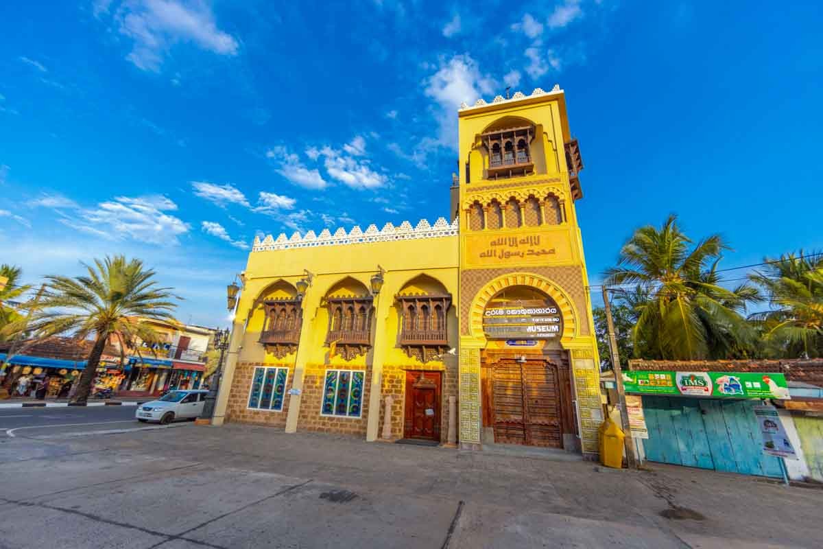
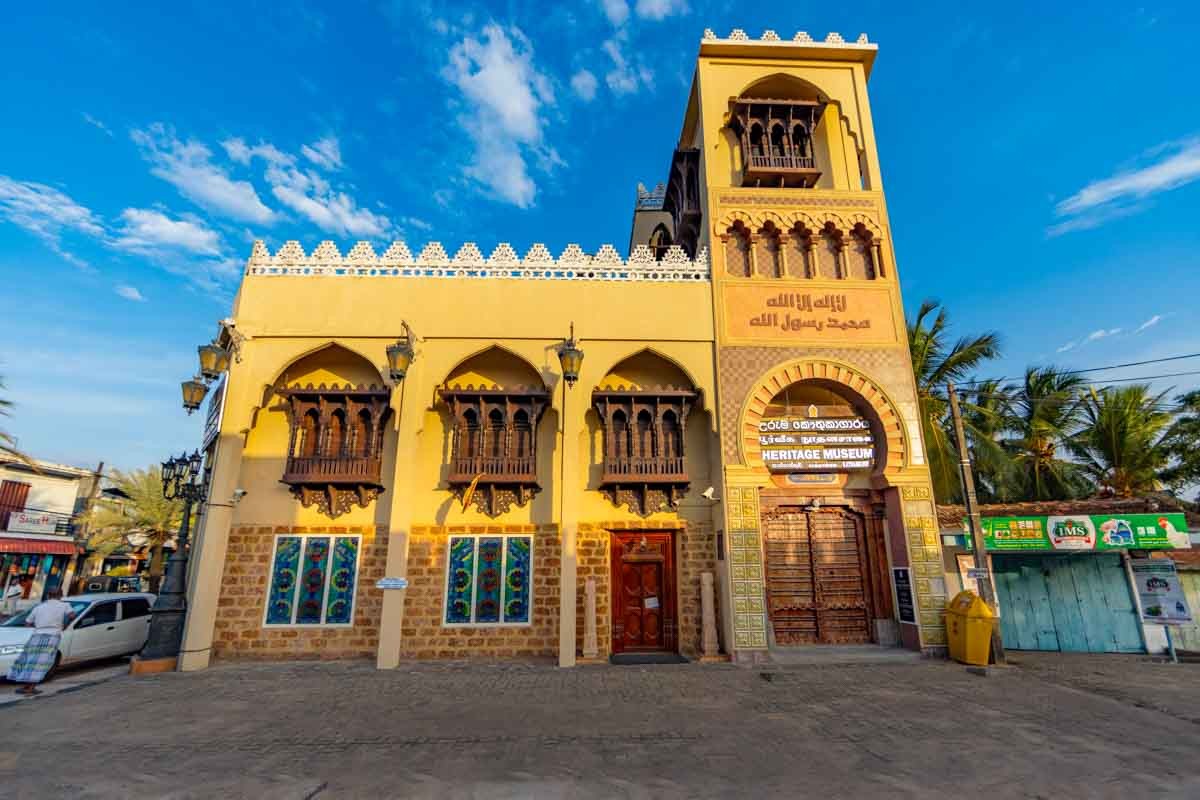
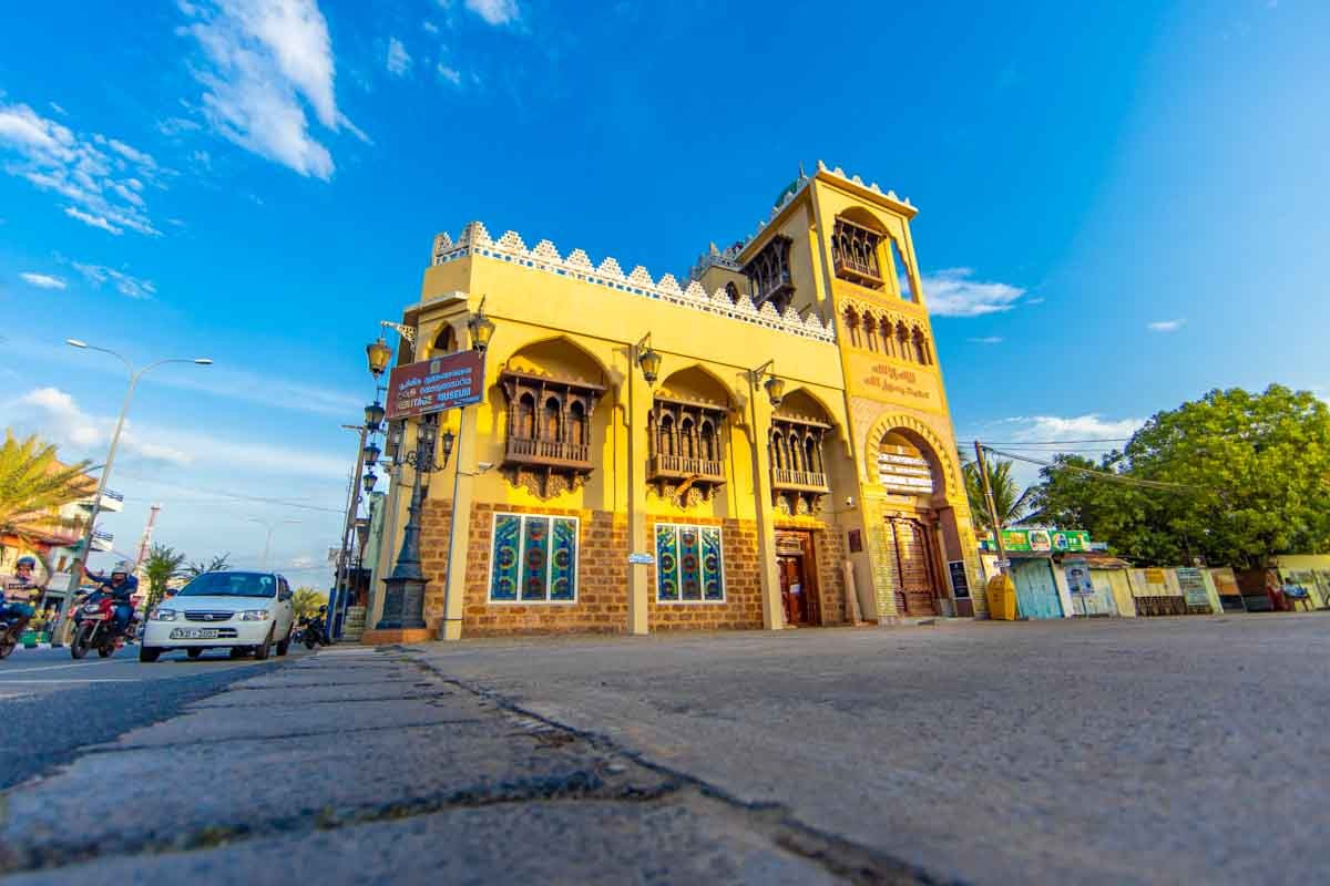
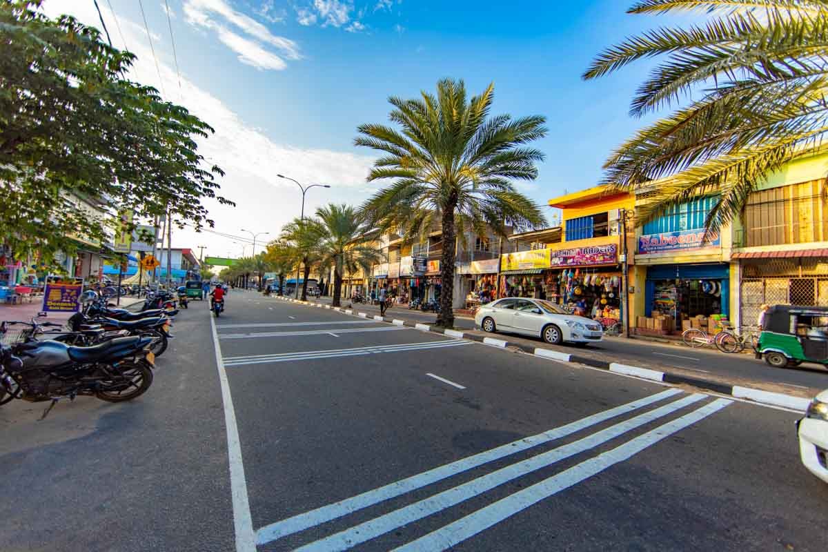
Heritage Museum
Situated in Sri Lanka’s most densely populated city of Kattankudy, the Heritage Museum of Kattankudy is a treasure trove to understand Sri Lanka’s unique and diverse culture that embodies the peaceful coexistence of all the major religions dwelling in the country. Filled with numerous artefacts and other exhibits that provide a comprehensive history of Muslims and Arab traders who visited and settled in the island throughout the centuries, it certainly is a treat in the eyes of the history buff.
Batticaloa Fort
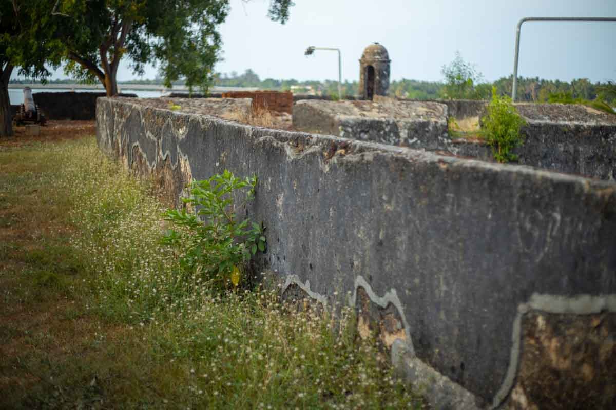
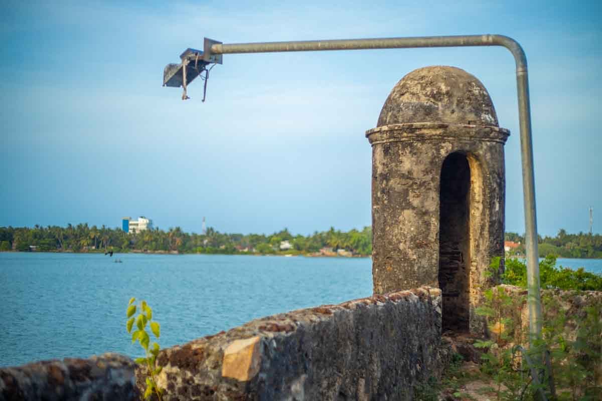
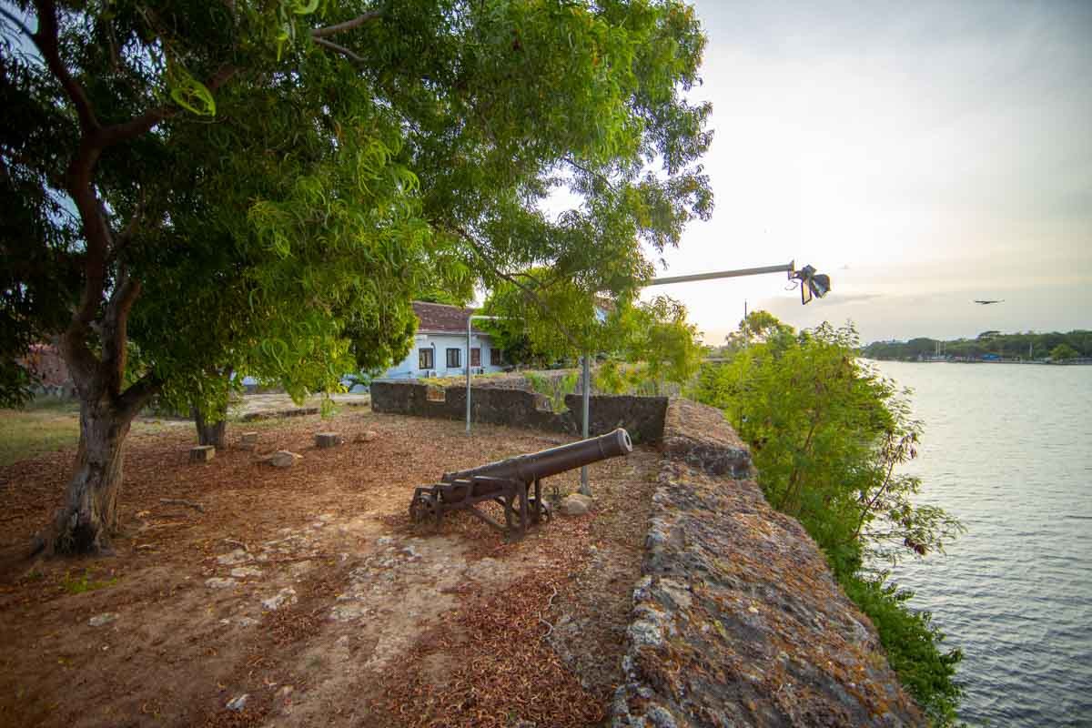
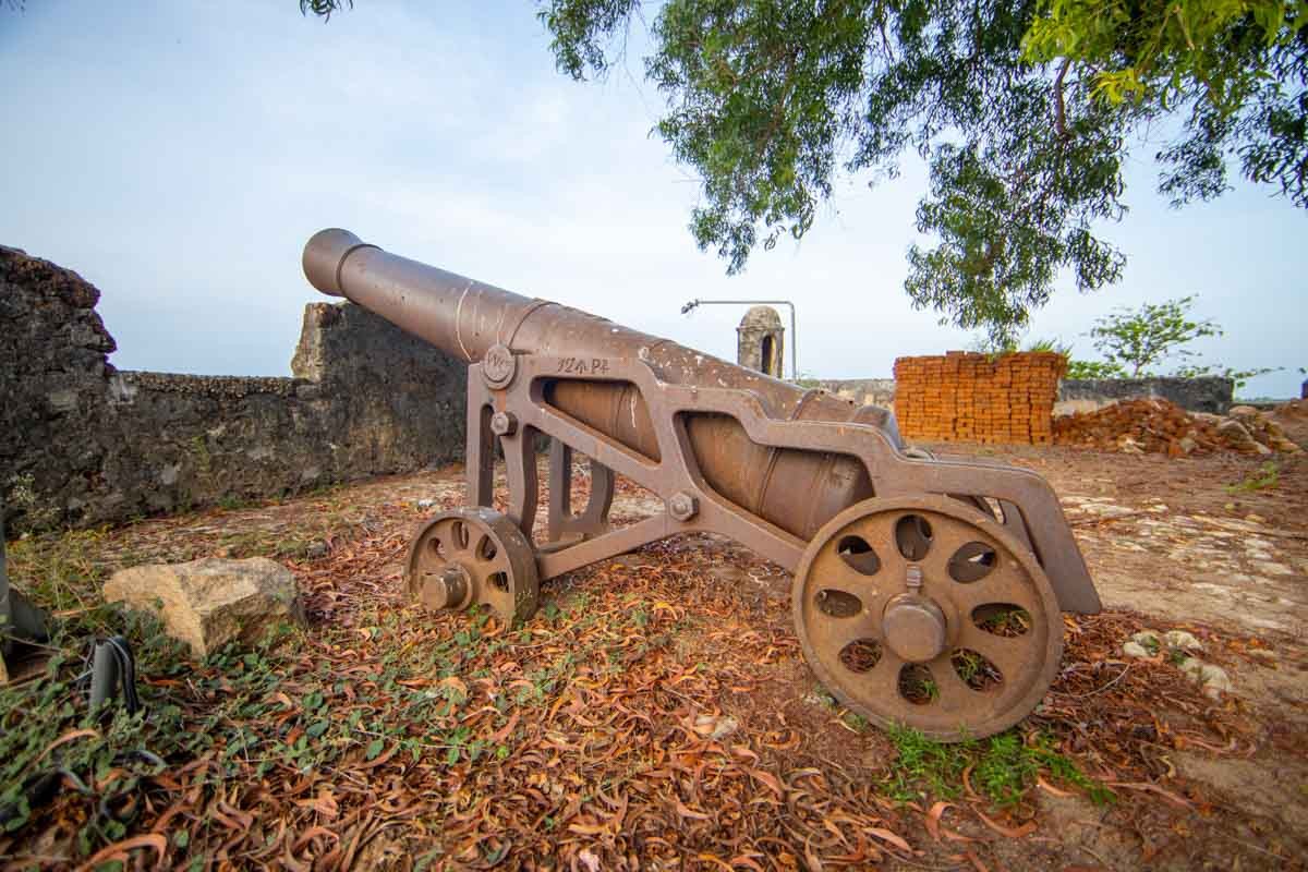
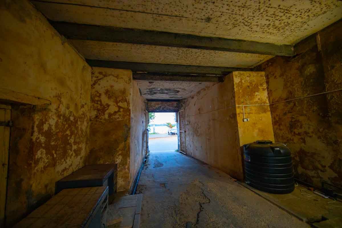
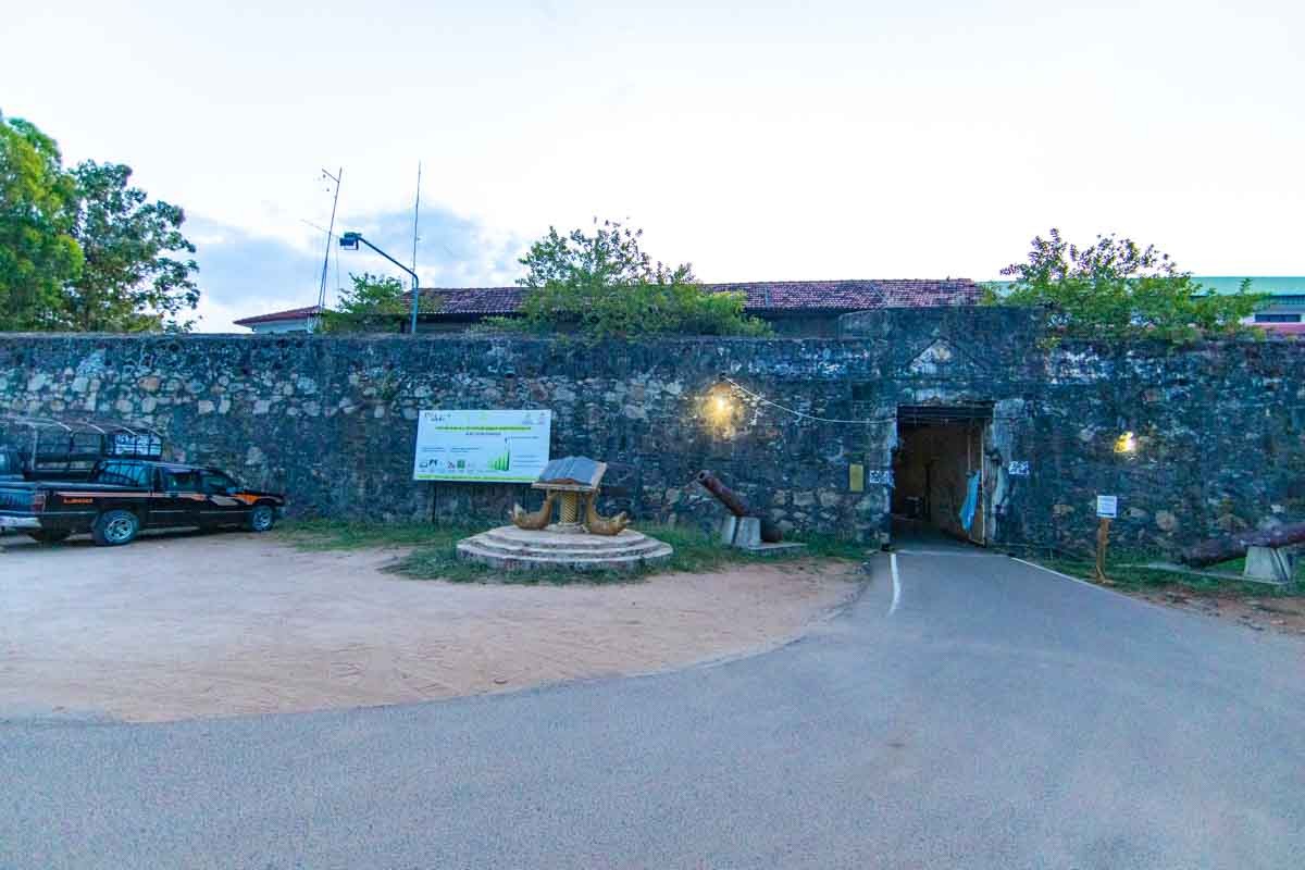
The Batticaloa Fort, known as Dutch Fort, is located at Puliyanthivu in the town of Batticaloa. The Batticaloa Fort is known to be built by the Portuguese in 1628 and was captured by the Dutch in 1638. From 1745, the fort is known to be used by the British rulers. It is known to be built with Granite Stones and coral. This is now the district secretariat of Batticaloa, and there is a small museum to enlighten visitors on the history. There are more historical ruins. Around one third of the fort is surrounded by Batticaloa lagoon in a side and the other two sides are surrounded by canals that are known to be used as a protective mechanism hosting crocodiles. The fort still remains in a considerable situation giving space for several government departments including the District secretariat of Batticaloa.The Batticaloa Fort, known as Dutch Fort, is located at Puliyanthivu in the town of Batticaloa. The Batticaloa Fort is known to be built by the Portuguese in 1628 and was captured by the Dutch in 1638. From 1745, the fort is known to be used by the British rulers. It is known to be built with Granite Stones and coral. This is now the district secretariat of Batticaloa, and there is a small museum to enlighten visitors on the history. There are more historical ruins. Around one third of the fort is surrounded by Batticaloa lagoon in a side and the other two sides are surrounded by canals that are known to be used as a protective mechanism hosting crocodiles. The fort still remains in a considerable situation giving space for several government departments including the District secretariat of Batticaloa.
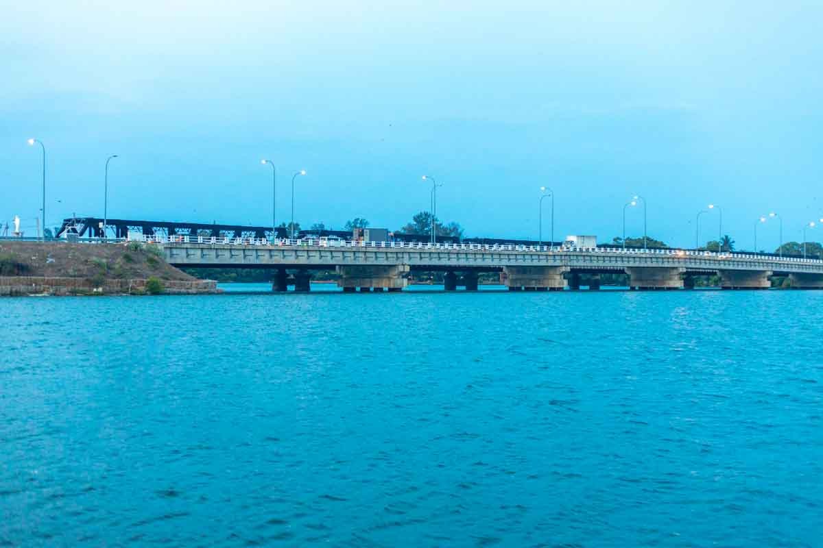
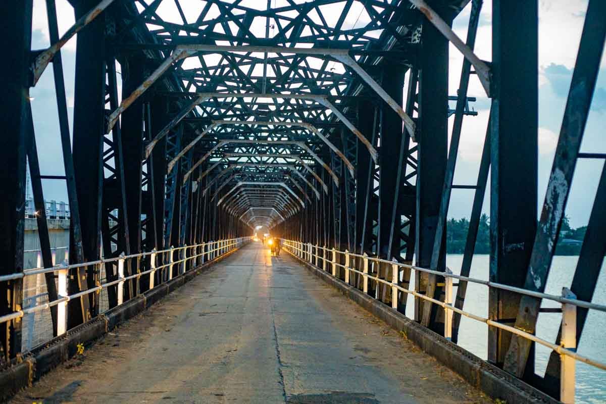
Kallady Bridge
The Batticaloa lagoon was obstructive to the traveling towards the southern part of Batticaloa in the ancient Batticaloa. People used small boats to cross over the lagoon to travel the south part of Batticaloa by paying one cent for boat fare during the early days. Later, one Mr.Maniyathar, the boat owner, used an engine boat to transport people and other commodities. In 1924 the construction work was started for a bridge, and it was completed in 1928. It was ceremonially inaugurated by the then governor of Sri Lanka Hon. Sir Manning and his wife Lady Manning. The bridge's lifetime was 1928-1985 as anticipated by the construction engineers, but the bridge was in use up to 2013. A new bridge along the old one was built by the government of Sri Lanka and was ceremonially opened by the then president Hon. Mahinda Rajapaksha on 13th March 2013.
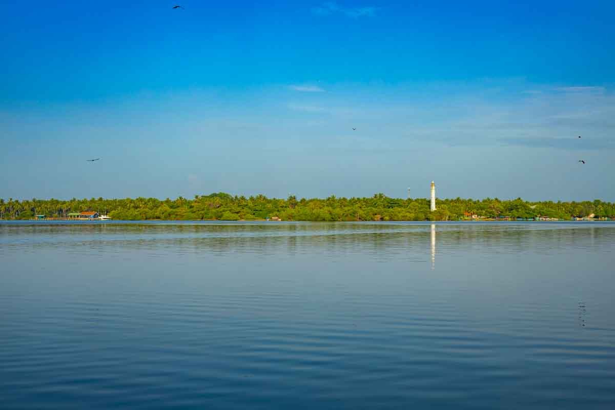
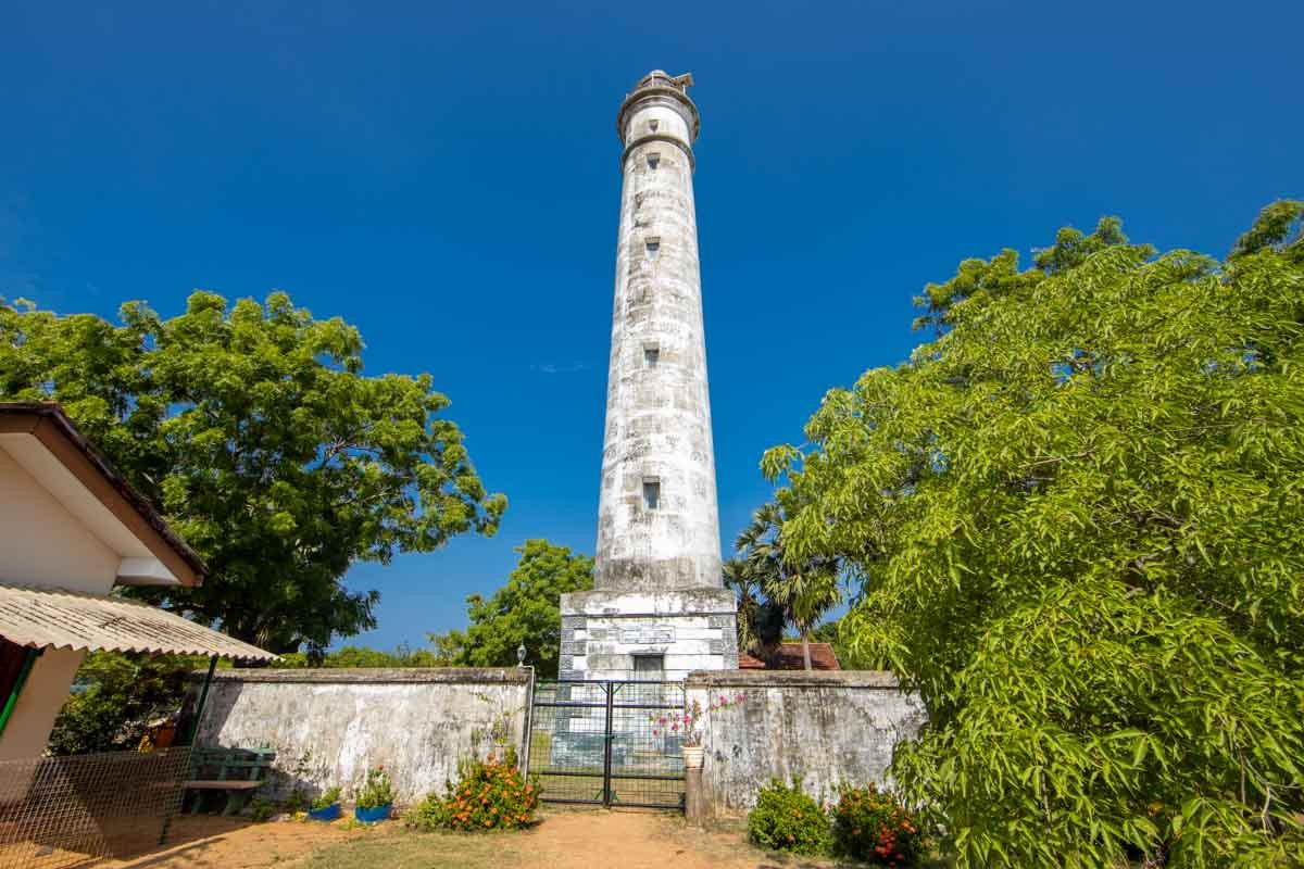
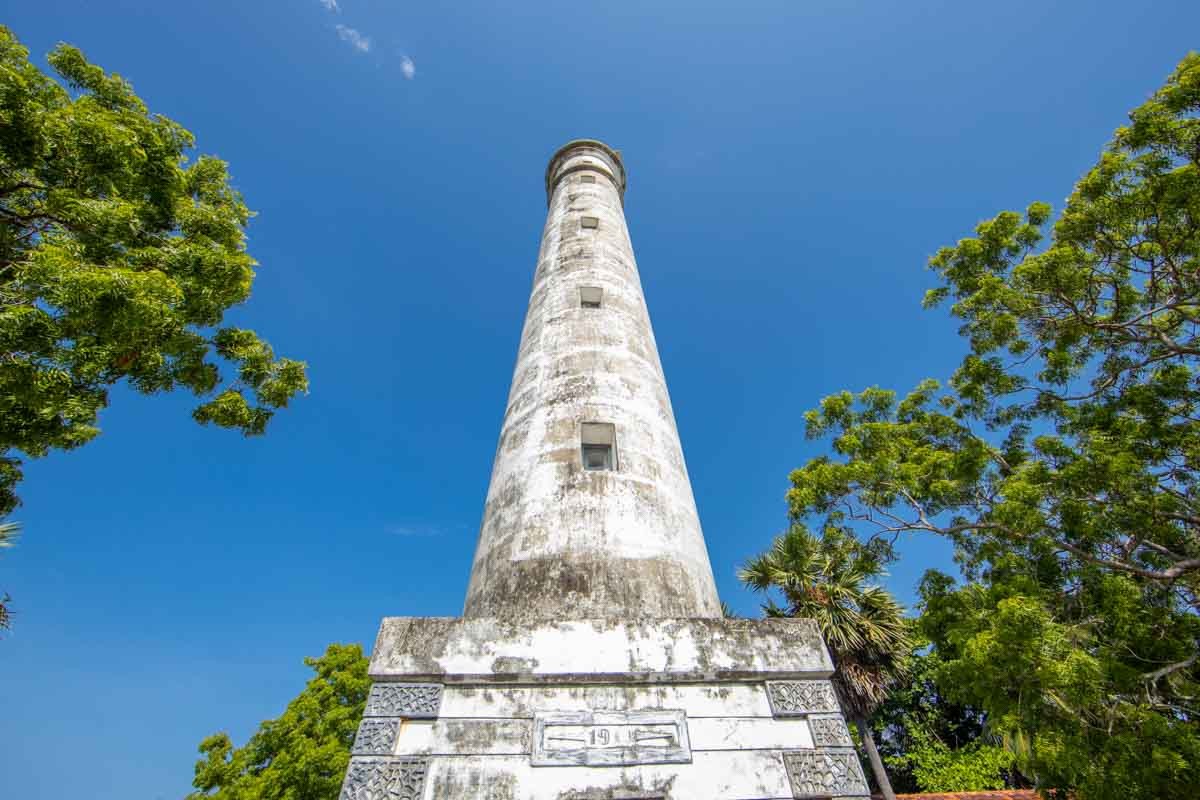
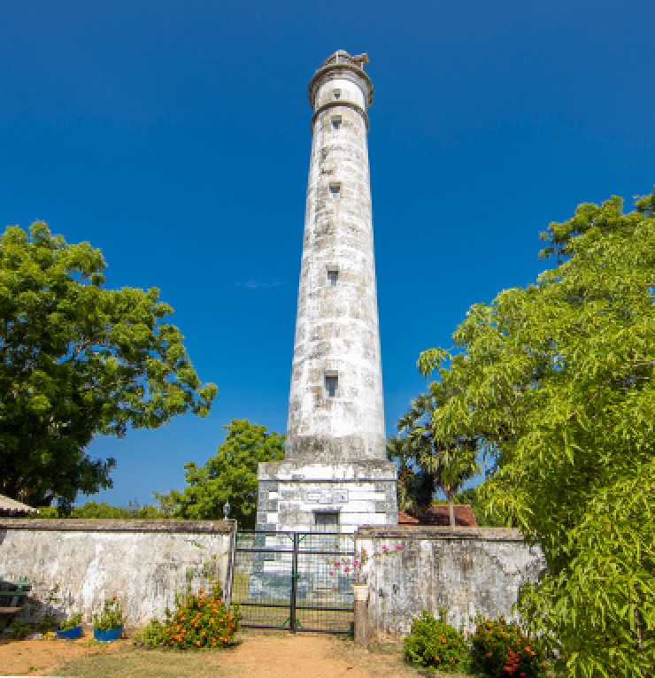
Batticaloa Lighthouse
Batticaloa Lighthouse is one of the landmarks of British colonial heritage built in 1913. It is located in the area where the lagoon meets the ocean. Lighthouse is situated 5 km from Batticaloa city, on Bar Road, near the estuary in Palameenmadu. It can be accessed by taking Lake Road (Munich Victoria Friendship Road) near the Kallady Bridge. This area is amazing for cycling and walking.
This is 28 meters tall. Sequences of ladders are provided to reach the top to get an awe-inspiring view of magnifying surroundings. The view from the top is one of the most splendid panoramas of the endless sea and Thoppigala Mountain is a supplemental pleasure. However, the public are not permitted to climb through this monument.
The otherside of the lighthouse is surrounded by a sandbank, lagoon and a rich ecosystem of mangroves. Boat trips in the evenings are the best to enjoy the delightful view of the sunset. There are several boat services functioning from this end that take people a round trip through the lagoon and also to the nearby island park that is also known as bone island park. Swimming in the calm water, surrounded by islands and islets, is the big draw to this site.
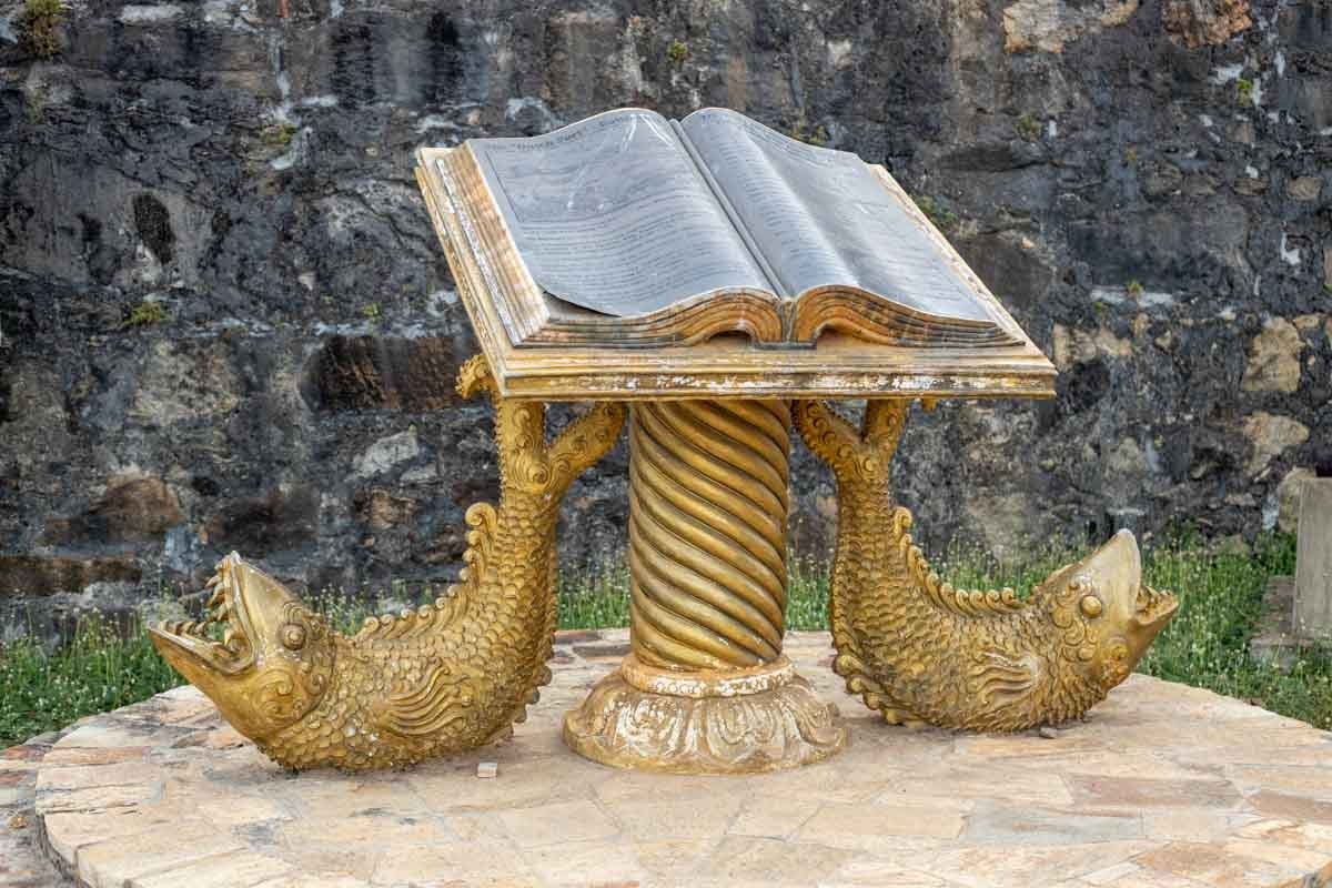
The closest hotspots are a marine eco museum situated near this site, that hosts many valuable monuments from the history of Batticaloa.
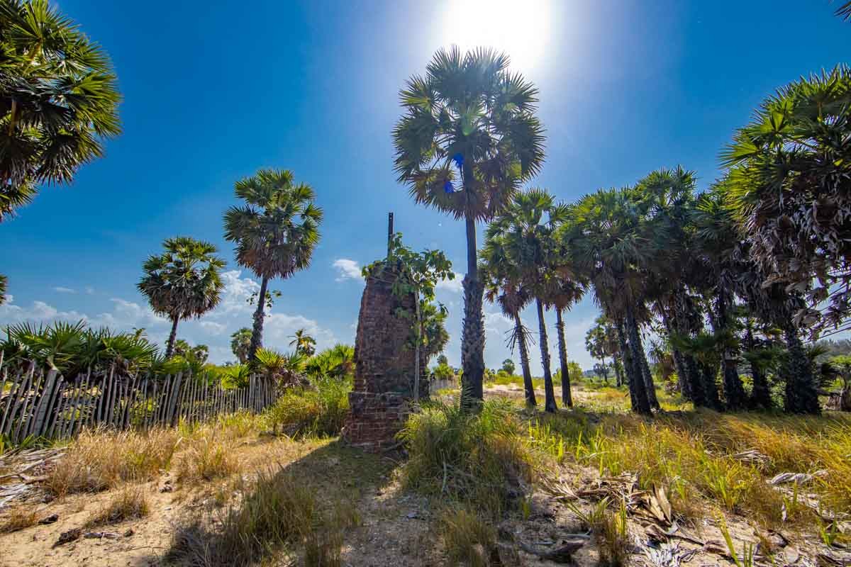
Mottakori
This can be achieved when the current light is used to travel approximately 500 meters to the northwest. It is approximately 100 meters from the sea, demanding the mound.
This light house is currently in ruins. The people of Avur say that their present ancestors have been claiming that this is a half-built building that has been demanding for over a hundred years. Kamaleswaran (age 67), a local resident, said that his grandfather had told him that the mound was in demand in 1913 and earlier. They have built a long railway in the middle of the building to ensure the stability of the building when it comes to the ruined mound. So it is my assumption that this was probably the British building after the commencement of railway services to Sri Lanka (1858). It is squarely built of bricks and they are so durable that they have survived the natural disasters of all time. The sea must have expanded slightly to where it is today, at the time when this light house was built. Evidence of this may be attributed to the increased presence of downstream boulders and the presence of natural salinity ponds or sinks during excavations. At that time, fishermen would go to sea for only nine months. The other three months are spent respecting the sea and not going fishing. They say that during that time, the sea breeze is called "Madak wind" and "hunger wind". During this time of hunger and winds, the fish collected naturally in the seawater outside the sea can be caught by a fisherman. One of the mature fishermen in the area, who ended up telling the story of the events of the time with interesting stories. Most of the ships that come to the sea, ie. From the lighthouse, the gestures from the lighthouse to the vessels. The term lamb here must have had similar characteristics to the seaweed used by fishermen. This means that it is a flame-like structure that can attack sea air for a long time. Kerosene oil is used to burn this. The height of the lighthouse is relatively low, as the sea is very close and the presently grown whitewashed structure is not visible at the time. The height of the pillars, which now bear the electrical wires found along the street, is known to be high. There were boats in the area of Machucha and Vattai, which were used to transport goods from India to the Batticaloa Fort, and then transport them to Batticaloa Fort via Batticaloa Vavi. The fishermen's conversation about the tiles and gems brought here from India can be traced back to the fact that they earn a little more income from the work of unloading these goods than fish. It is the responsibility of all of us to preserve the ancient symbols while it is natural to forget the old when the new ones arrive.